Fishing the Owens River: Current Conditions & Eastern Sierra Guide
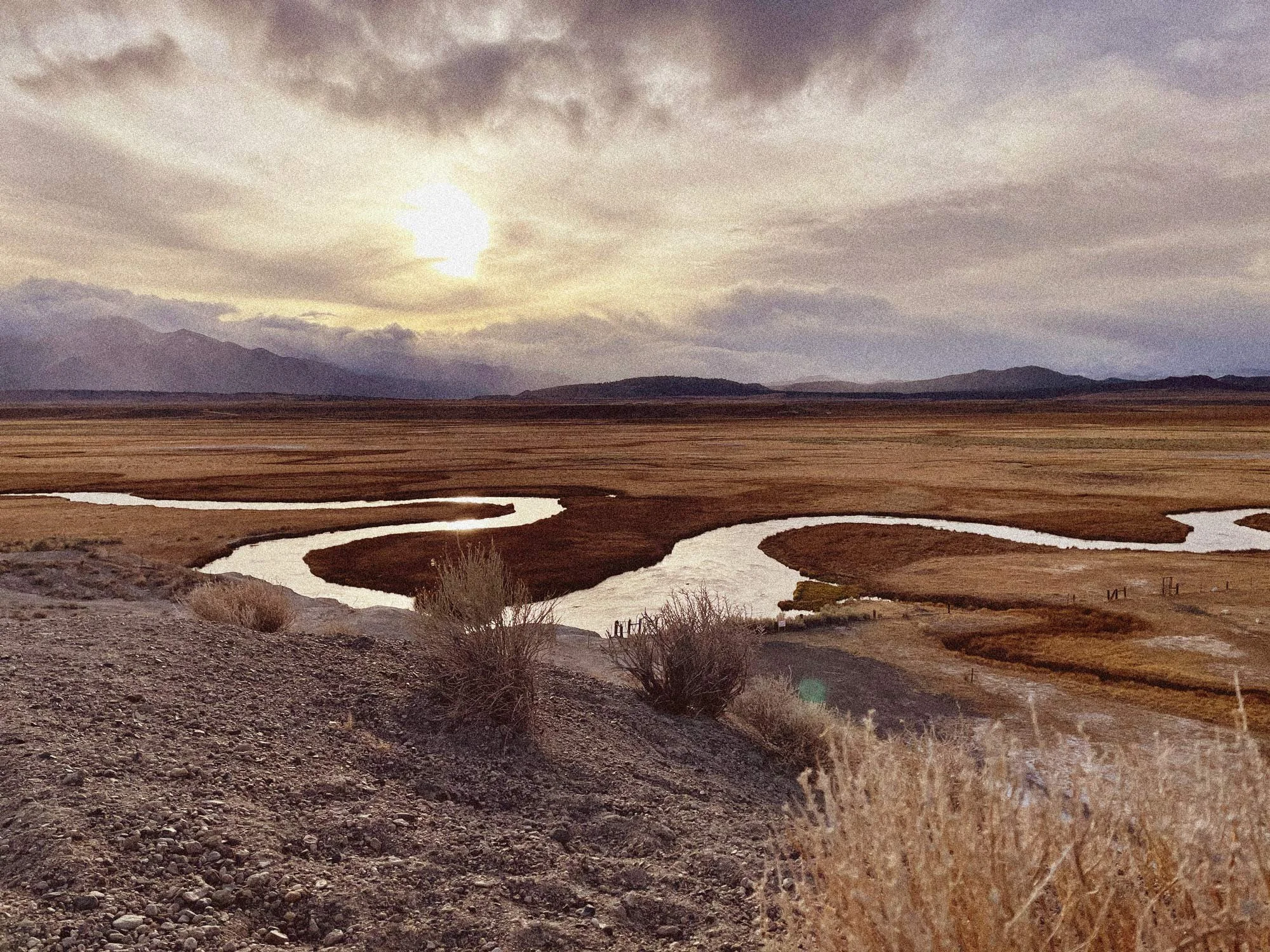
The Owens River runs through two very different Eastern Sierra landscapes. Above Crowley Lake, it winds through the open meadows of Long Valley beneath the Sierra Nevada. Farther south, below Pleasant Valley Reservoir, it becomes a high-desert tailwater flowing through the Owens Valley outside Bishop.
Both sections offer year-round trout fishing, but knowing which one to fish often comes down to conditions. Flow releases can change quickly. Summer heat can push water temperatures into stressful territory for trout. Winter weather can complicate access on the Upper Owens, while high flows can make sections of the Lower Owens difficult to wade.
The current conditions below bring the most useful trip-planning information together in one place before you head for the river.
OWENS RIVER
Current Conditions
Upper Owens
Below East Portal / Long Valley
Lower Owens
Below Pleasant Valley Reservoir
Hot Creek
Long Valley / Mammoth Lakes
*Hot Creek temperature: Hot Creek is geothermally influenced. The USGS temperature reflects conditions at the monitoring location and should not be interpreted as the water temperature throughout Hot Creek or the nearby Upper Owens.
River data: LADWP + USGS · Weather: National Weather Service. Source observations may be delayed from current conditions due to agency reporting intervals and processing times. River data are preliminary and subject to revision. Conditions can vary throughout each reach.
Flow matters differently on different parts of the Owens. The Upper Owens reading comes from below East Portal in Long Valley, while the Lower Owens reading reflects outflow from Pleasant Valley Reservoir. Hot Creek is shown separately because it adds water to the Upper Owens downstream of the East Portal gauge. A single CFS number doesn't describe the entire river, so pay attention to the 24-hour change and five-day trend as well as the current flow.
Weather observations are included as another trip-planning reference, but conditions can vary considerably between Long Valley and the Owens Valley. Water temperature is shown only where a reliable live measurement is available.
Owens River at a Glance
| Upper Owens River | Lower Owens River | |
|---|---|---|
| Area | Long Valley, north of Crowley Lake | Owens Valley, north and east of Bishop |
| Character | Open meadow river with bends, pools and undercut banks | Tailwater winding through the high desert |
| Primary Trout | Brown and rainbow trout | Brown and rainbow trout |
| Best Known For | Migratory trout from Crowley Lake, winter fishing and classic meadow water | Wild trout water, winter fishing and accessible wading at lower flows |
| Flow Reference | Owens River below East Portal | Pleasant Valley Reservoir outflow |
| Access | Mix of public access and private ranch property | Numerous access points below Pleasant Valley Reservoir; vegetation becomes heavier downstream |
| Key Consideration | Conditions and access can change considerably along the river | Flow has a major effect on wadability and access |
| Fishing Season | Year-round, with special regulations depending on the reach and time of year | Year-round, with special regulations depending on the reach and time of year |
Between Long Valley and Bishop, the Owens changes enough that it helps to think of the Upper and Lower river as separate fisheries. Access changes, the surrounding landscape changes, and a flow that presents few problems on one section can make another considerably more difficult to fish.
Upper Owens or Lower Owens: Where Should You Fish?
The Upper Owens winds through Long Valley north of Crowley Lake. Much of the river has the look people associate with classic Eastern Sierra fly fishing: open grassland, sweeping bends, undercut banks and long views toward the mountains. Brown and rainbow trout live in the river throughout the year, while larger fish can move out of Crowley Lake and into the Owens at different points in their spawning cycles.
The open terrain can make the Upper Owens look deceptively simple. Fish have plenty of opportunity to see an angler approaching, access varies along the river, and portions of the middle and upper river pass through private ranch property. Winter adds another variable: dirt-road access that is straightforward in dry weather can become considerably more difficult after snow or during a thaw.
The Lower Owens is a different river. Below Pleasant Valley Reservoir, the Owens runs through the high desert north of Bishop before continuing south through the Owens Valley. The stretch below the reservoir includes designated Wild Trout Water and is particularly well known as a winter fishery, when cooler temperatures can make conditions much more comfortable than they are during the heat of summer.
Here, flow deserves particular attention. Lower water can open up more opportunities for wading, while high releases from Pleasant Valley Reservoir can make familiar stretches much more difficult to fish on foot. Farther downstream, dense willows and other riparian vegetation can make simply reaching the water part of the challenge.
Neither section is inherently the better choice. If you're deciding between them, start with the current conditions above. Lower flows can make the Lower Owens considerably easier to explore on foot, while changes in the Upper Owens can affect both access and where fish are holding. Weather matters too: Long Valley sits considerably higher than Bishop, so conditions on the two sections can be surprisingly different on the same day.
Fishing the Upper Owens River
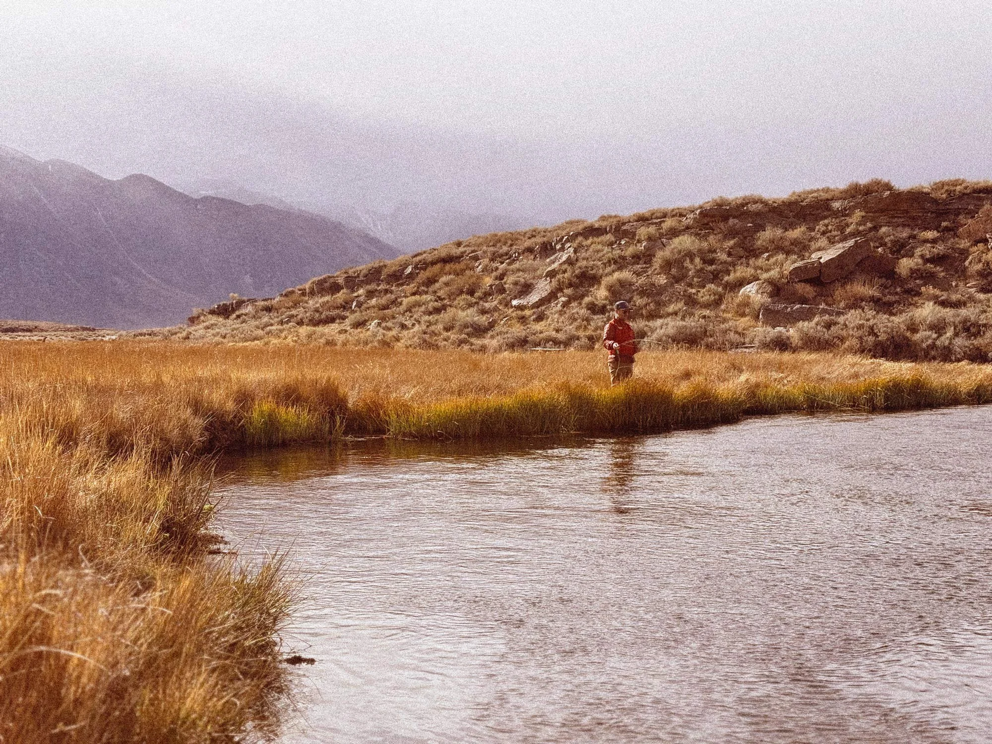
The Upper Owens flows through the open meadows of Long Valley before entering Crowley Lake. For anglers, much of the commonly fished water lies north of the lake around Benton Crossing and farther upstream.
It's relatively small water in a very large landscape. Sagebrush and grassland leave little cover along the banks, so an approaching angler can be surprisingly visible. Staying back from the water, watching your shadow and taking time to look before walking to the bank can make a difference.
Crowley Lake and Migratory Trout
Resident brown and rainbow trout occupy the river throughout the year, but fish from Crowley Lake also move into the Owens seasonally. Those migrations help explain why the Upper Owens can produce fish considerably larger than the river's modest size might suggest.
Timing varies with conditions and fish behavior, so these movements are better understood as part of the river's seasonal cycle than something that happens on a fixed date.
Understanding the Upper Owens Flow Reading
The live flow at the top of this guide comes from LADWP's Owens River Below East Portal gauge. That gauge is upstream of the Hot Creek confluence, so it doesn't represent the total flow anglers encounter farther downstream toward Crowley Lake.
That's why Hot Creek appears separately in the current-conditions module. Use the East Portal reading as a reference and pay attention to the 24-hour change and five-day trend, particularly when flows are moving quickly.
Accessing the Upper Owens
Benton Crossing Road provides the main approach to much of the commonly fished Upper Owens, with dirt roads and tracks providing access to different stretches of river. These can be straightforward in dry weather but considerably more difficult after snow, rain or periods of thawing.
Some stretches also pass through private ranch property. Respect posted boundaries, use established access where available and leave gates as you found them.
Fishing the Lower Owens River
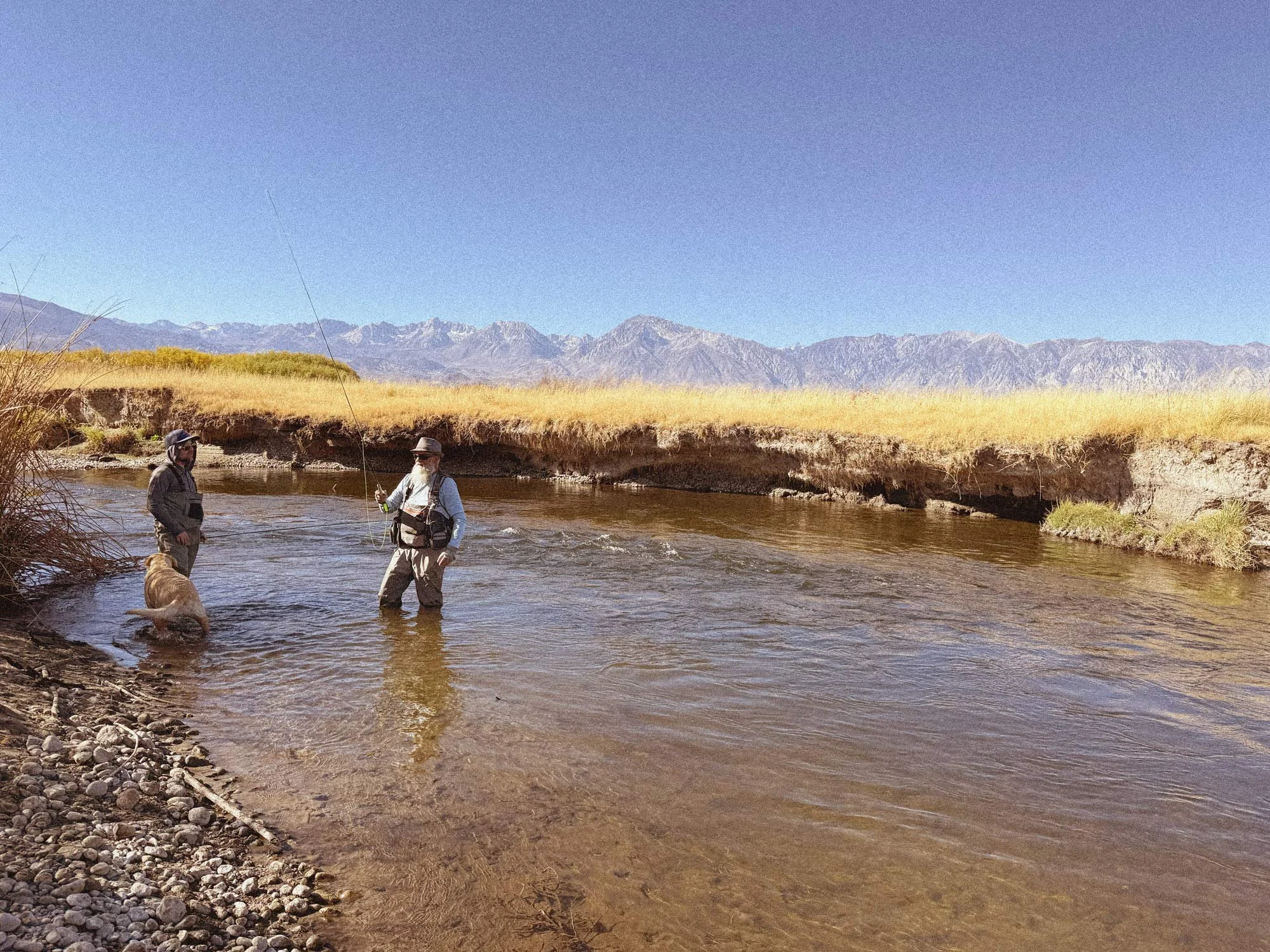
Below Pleasant Valley Reservoir, the Owens enters the broad valley north of Bishop, winding through sagebrush, cottonwoods and willows with the Sierra rising abruptly to the west.
The Lower Owens includes designated Wild Trout water and supports both brown and rainbow trout. Its lower elevation also makes it one of the Eastern Sierra's better-known cold-season fisheries. When lakes and streams around Mammoth are buried beneath snow, conditions along the Lower Owens can be comparatively mild.
Flow Changes the Lower Owens
If there's one number to check before fishing the Lower Owens, it's the release from Pleasant Valley Reservoir. That's why the conditions module above uses Pleasant Valley Reservoir outflow rather than LADWP's separate "Owens River at PV" measurement.
Flow has a major effect on how the river fishes on foot. Around 200–250 CFS, local Eastern Sierra guides commonly describe much more manageable wading conditions. Once flows climb above roughly 300 CFS, options can become increasingly limited; at 400–500 CFS, familiar stretches can present a very different river.
These are useful points of reference, not safety thresholds. Depth, current, riverbed conditions, location and experience all matter. Check the current flow along with the 24-hour change and five-day trend above—a rapidly rising river deserves additional caution.
Accessing the Lower Owens
Much of the commonly fished water begins below Pleasant Valley Reservoir and continues downstream toward Bishop. Some stretches are readily approached from nearby roads, while dense willows and other riparian vegetation can make access considerably more difficult farther downstream.
Road work, water-management operations and temporary closures can also affect access around Pleasant Valley. Check current conditions before assuming a familiar road or access point is open.
Understanding Owens River Flow Rates
River flow is measured in cubic feet per second, usually abbreviated CFS. One cubic foot is roughly 7.5 gallons, so a reading of 200 CFS represents about 1,500 gallons of water passing the measuring point every second.
The number alone only tells part of the story. A river holding near 190 CFS for several days presents a different situation from one that has risen from 90 to 190 CFS in a short period. Rapid changes can affect current, clarity and access, which is why the conditions above show both current flow and recent trends whenever the underlying data are available.
What Is a Good Flow for the Owens River?
There isn't one ideal flow for the entire Owens.
On the Upper Owens, the East Portal gauge measures the river upstream of Hot Creek, so the reading doesn't represent all of the water eventually reaching Crowley Lake.
On the Lower Owens, flow has a much more noticeable relationship with access and wadability. Local Eastern Sierra guides commonly reference roughly 200–250 CFS as more manageable for experienced wading anglers, with options becoming increasingly limited as releases rise. These numbers are context, not guarantees that a particular stretch is safe or productive.
Water Temperature and Trout
Flow isn't the only number worth checking. Trout are cold-water fish, and warmer water holds less dissolved oxygen. As temperatures rise, catching and handling fish can add stress at a time when they're already working harder to obtain the oxygen they need.
This becomes particularly important during hot Eastern Sierra summers. Water temperature can also vary substantially along the same river depending on shade, groundwater, tributaries, reservoir releases, elevation and time of day. A temperature measured several miles away should never override what a thermometer tells you at the water you're actually visiting.
There isn't a single temperature at which conditions suddenly become unsuitable for every trout. Species, duration of exposure and other environmental conditions all matter. As a practical conservation measure, anglers should become increasingly cautious as cold-water fisheries move into the upper 60s. During periods of sustained heat, California wildlife officials and Eastern Sierra fishing guides have encouraged anglers to concentrate activity during cooler morning hours and avoid adding unnecessary stress as water approaches potentially harmful temperatures.
A note about the Hot Creek reading: The live temperature displayed above comes from a USGS monitoring station in Hot Creek, which passes through an active geothermal system within the Long Valley Caldera. Hot springs introduce heated groundwater into portions of the creek, producing unusually high readings at the monitoring location. The number is a real instrument measurement, but it does not represent the temperature of the entire Hot Creek fishery or the nearby Upper Owens River.
Wind and Weather
Weather can be remarkably different between the Upper and Lower Owens.
The Upper Owens is exposed in the open landscape of Long Valley, where afternoon winds can develop quickly. The Lower Owens sits thousands of feet below Mammoth Lakes, so conditions around Bishop can be considerably warmer.
That difference is especially noticeable in winter, when a cold or snowy morning around Mammoth can give way to a comparatively mild afternoon in the Owens Valley. In summer, the opposite becomes important: Bishop and the Lower Owens can be extremely hot even when Mammoth feels comfortable.
Check the weather for the section of river you're visiting rather than relying on conditions in Mammoth Lakes.
When Is the Best Time to Fish the Owens River?
The Owens is a year-round Eastern Sierra fishing destination, but conditions vary considerably between the Upper and Lower river and throughout the seasons. Flow, access, weather, water temperature and current regulations should all factor into when you visit.
Winter
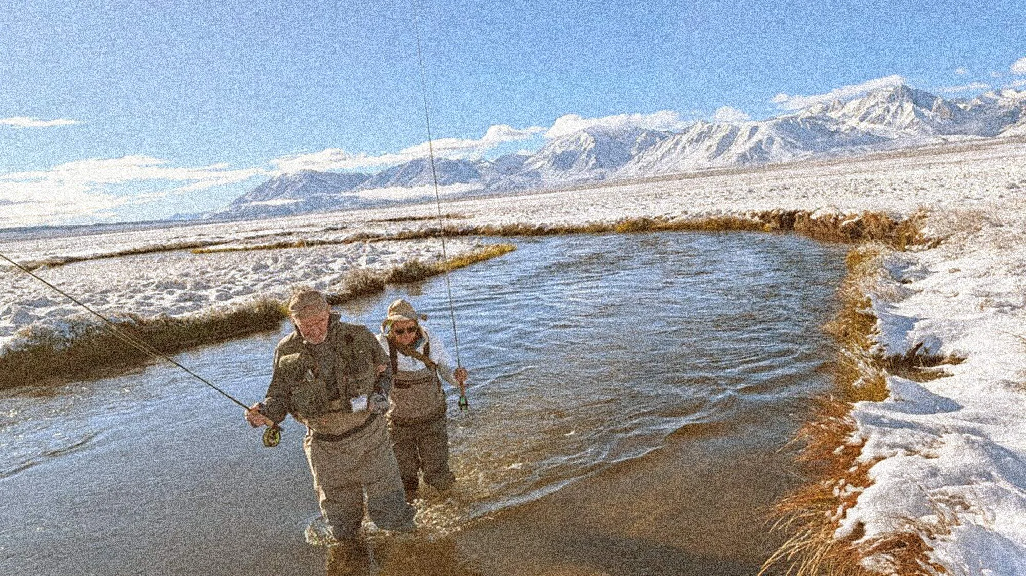
Winter is one of the distinctive seasons on the Owens. The Lower Owens can remain accessible while much of the surrounding high country is buried in snow, and portions of the Upper Owens are also open under special regulations.
Snow, ice and muddy roads can complicate Upper Owens access, while the lower elevation around Bishop often provides considerably milder conditions.
For winter visitors staying in Mammoth Lakes, the Owens also provides an opportunity to experience a very different side of the Eastern Sierra away from the mountain.
Spring
Longer days and warming weather arrive in spring, but conditions can change quickly. Water-management releases, runoff elsewhere in the watershed and variable weather can all affect the river.
Current flow and recent trends are particularly worth checking before a spring trip.
Summer
Summer brings heat into the Owens Valley, particularly along the Lower Owens near Bishop. Water temperatures deserve additional attention during hot periods, and conditions can differ substantially between the Upper and Lower river.
Check current weather and water temperature where available, and carry a stream thermometer when temperatures are a concern.
Fall
Cooling nights generally bring more comfortable temperatures back to the Owens Valley. On the Upper Owens, fall also coincides with seasonal fish movement associated with Crowley Lake.
Weather in Long Valley can change abruptly as the season progresses, with freezing temperatures and early snow possible well before winter conditions settle into the lower Owens Valley.
Trout in the Owens River
Brown and rainbow trout make up the primary sport fishery throughout the Owens River system. The Upper Owens supports resident trout as well as seasonal movement of fish from Crowley Lake, while portions of the Lower Owens are managed as designated Wild Trout water.
CDFW also stocks trout in parts of the broader Owens system. Planting schedules can be useful when planning a trip, but scheduled dates can change and shouldn't be treated as an indication of current river conditions.
Owens River Fishing Regulations
Regulations on the Owens can change from one reach to another, making your exact location important. Different sections may have different seasons, tackle restrictions, size limits and possession limits, and crossing a bridge or other regulatory boundary can put you under a different set of rules.
The table below identifies several of the major sections anglers should recognize. It is a navigation aid, not a substitute for the current California Department of Fish and Wildlife regulations.
| River Section | Why It Matters |
|---|---|
| Upper Owens: Big Springs to Benton Bridge | Special year-round regulations apply, including tackle and harvest restrictions. |
| Upper Owens: Benton Bridge to Crowley Lake | Regulations change seasonally; check current dates, tackle restrictions, size limits and possession limits. |
| Lower Owens: Pleasant Valley Dam to the lower Pleasant Valley Campground footbridge | Seasonal regulations apply and differ between the general and winter fishing periods. |
| Lower Owens: Campground footbridge to Five Bridges Road | Special Wild Trout regulations apply. |
| Other Owens River reaches | General regulations may apply unless the water is otherwise listed. Always verify your exact location. |
Regulations checked: September 2026.
Before fishing, verify the current rules for the exact reach you're visiting with the California Department of Fish and Wildlife's current Freshwater Sport Fishing Regulations.
Trout Stocking
The California Department of Fish and Wildlife maintains a regularly updated Fish Planting Schedule for the Owens River and nearby Eastern Sierra waters.
Stocking dates can change because of weather, road conditions, water temperature and hatchery operations, so check the current schedule directly with CDFW rather than relying on a static calendar.
Stocking is only one part of the Owens fishery. The river also supports naturally reproducing trout populations, and portions of the Lower Owens are designated Wild Trout Water.
Current Fishing Reports and Local Knowledge
Live data can tell you what the river is doing, but it can't tell you everything happening on the ground.
For recent observations about access, changing river conditions and what anglers are encountering, local fly shops and guides remain an important source. The businesses below are established Eastern Sierra resources worth checking before a trip.
| Local Resource | Location | Contact / Resource |
|---|---|---|
| STM Fly Shop & Guide Service | Bishop | (760) 873-0010 |
| The Troutfitter | Mammoth Lakes | (760) 924-3676 |
| Sierra Bright Dot | Bishop | Eastern Sierra fishing reports |
These reports are particularly useful when conditions are changing quickly. A gauge can show that the Lower Owens has risen substantially over several days; someone who has recently been on the river can provide context for what that change looks like on the ground.
Fishing the Owens Responsibly
The Owens is a remarkable fishery running through an equally remarkable Eastern Sierra landscape. A few simple habits help reduce our impact.
Pay particular attention to water temperature during periods of summer heat. Handle trout with wet hands and keep them in the water whenever possible. Avoid walking through visible spawning redds. Pack out discarded line and other fishing debris, and respect private property, fences, gates and posted closures.
Sometimes the responsible decision is simply to stop fishing. A hot afternoon, a spawning fish or a stretch of water that shouldn't be disturbed doesn't need to become an opportunity missed.
Come home empty handed.
The Owens Beyond the River
The Owens River is part of a much larger Eastern Sierra landscape. On the Upper Owens, Mammoth Lakes, Crowley Lake, Hot Creek and the Long Valley Caldera are all close by. Follow Highway 395 south and the river continues into the broad Owens Valley beneath the eastern escarpment of the Sierra Nevada.
In winter, that makes the Owens an easy addition to a Mammoth trip that has very little to do with fishing alone. Ski or snowboard, explore the river, spend some time in Bishop, or simply follow Highway 395 south as the snow gives way to desert.
If you're visiting during the colder months, our Mammoth Lakes Winter Field Guide covers skiing, snowshoeing, transportation and other ways to explore the area beyond the river. You can also explore our Mammoth Lakes tee and the broader Sierra Collection, inspired by places throughout the Eastern Sierra and California high country.