Big Bend, the Border & the Future of a National Park
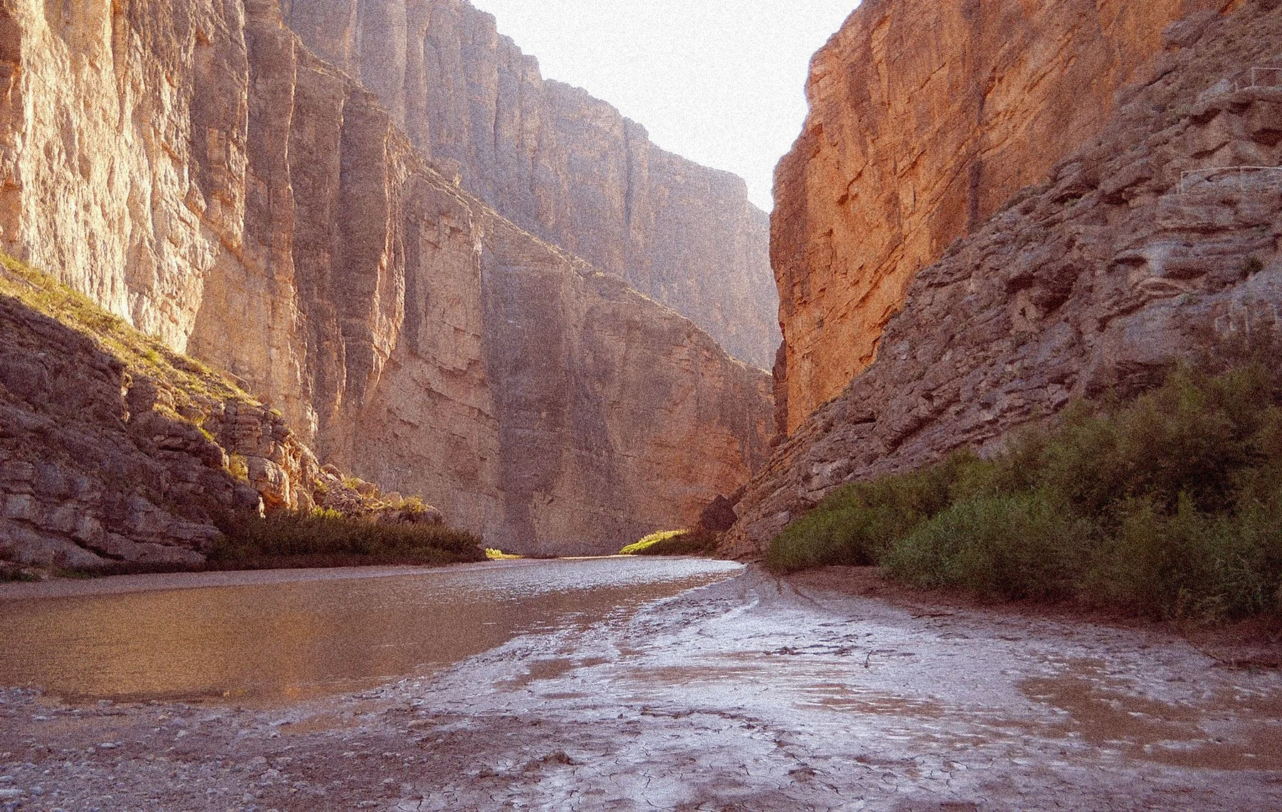
Santa Elena Canyon and the Rio Grande, Big Bend National Park. Original photo: Yinan Chen / Public Domain.
At the mouth of Santa Elena Canyon, the international border is easy to locate. The Rio Grande runs between two limestone walls rising more than a thousand feet above the river. The wall to the north is Texas; the one to the south is Chihuahua. Depending on the season, the water between them can be broad and brown or shallow enough that gravel bars occupy much of the canyon floor.
For 118 miles, the Rio Grande forms the southern boundary of Big Bend National Park and the international boundary between the United States and Mexico.¹ It is an unusually consequential line for a place where so much crosses it. Mountain ranges continue into Mexico. Wildlife moves between habitats in both countries. Much of the water flowing through the park arrives by way of a Mexican tributary, and communities along the river maintained relationships across it long before Big Bend became a national park.
Even the people who first pushed for the protection of Big Bend looked beyond the American side of the river.
They imagined an international park.
Nearly a century later, that idea offers a useful way to understand Big Bend. The international park was never created, yet the landscape it was meant to protect remains connected across the border. In 2026, with new border infrastructure being pursued in and around Big Bend, the consequences of that connection have become part of a much more immediate debate.
Before the Border
People had been moving through the Big Bend region for thousands of years before the Rio Grande became an international boundary. Archaeological sites throughout the park record a long history of Indigenous occupation, with people hunting, gathering plants and traveling between the region's scarce and widely dispersed water sources.²
Spanish exploration brought new claims beginning in the 16th century, followed by Mexican independence in 1821. The political geography changed again after the Mexican-American War. Under the Treaty of Guadalupe Hidalgo in 1848, the Rio Grande became part of the boundary between Mexico and the United States.
Life along the river did not suddenly reorganize itself around the new line. Ranching expanded through the region, mining operations brought workers and commerce, and small settlements developed on both sides. People crossed for work, supplies, family and trade. In an isolated part of the continent, relationships often developed around proximity and necessity.²
By the early twentieth century, much of the Big Bend country remained sparsely settled. The same isolation that had complicated life there was beginning to attract people interested in preserving it.
The Park That Was Supposed to Cross the Border
The movement to protect Big Bend gained momentum in Texas during the 1930s. From relatively early in that effort, advocates were thinking beyond state and national boundaries.
In 1933, the Alpine Chamber of Commerce proposed an international park encompassing land on both sides of the Rio Grande. Texas Senator Morris Sheppard raised the idea with President Franklin D. Roosevelt two years later. After Congress authorized Big Bend National Park in 1935, Secretary of the Interior Harold Ickes encouraged the State Department to pursue corresponding protection with Mexico.³
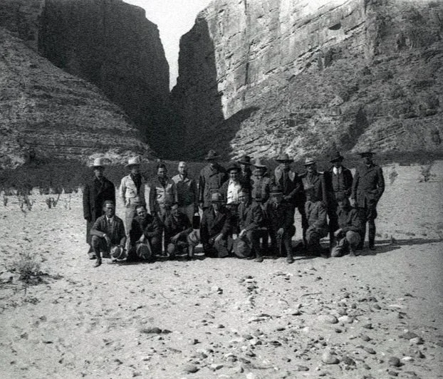
Members of the joint United States–Mexico International Park Commission at the mouth of Santa Elena Canyon, February 18, 1936. Mexico is at left; Texas at right. NPS Photo / George A. Grant.
The geography made a persuasive case. The mountains visible to the south from Texas were part of the same desert system park advocates hoped to preserve, and protecting only the American side left much of that landscape outside the proposed park.
Roosevelt continued to pursue the idea. In 1944, he wrote to Mexican president Manuel Ávila Camacho that the work in Big Bend would not be complete until the park area on both sides of the Rio Grande formed one international park.⁴ Big Bend National Park was formally established that year after Texas transferred roughly 700,000 acres to the federal government, but the larger international park never materialized.¹ Differences in land ownership, conservation systems and politics made a jointly protected park considerably more difficult to create than its advocates had hoped.
Mexico eventually pursued conservation on its own terms. Protected areas established across the river, including Maderas del Carmen, Cañón de Santa Elena and Ocampo, now join Big Bend in one of North America's largest transboundary protected landscapes. More than three million acres of Chihuahuan Desert resources and more than 200 miles of river are protected by the United States and Mexico.¹
What exists today resembles parts of the landscape envisioned in the 1930s, although it developed gradually under separate governments rather than as a single international park.
One Desert, Two Countries
Big Bend occupies the northern reaches of a Chihuahuan Desert that extends across much of northern Mexico and into Texas and New Mexico. Mountain ranges rise out of desert grasslands and scrub, creating isolated pockets of cooler habitat at higher elevations. Springs and river corridors provide water across a region where relatively small differences in elevation and rainfall can determine what survives.
The protected areas on either side of the Rio Grande matter partly because animals move through them. Mountain lions maintain large territories across the region. Mexican long-nosed bats migrate through the desert following flowering agaves and other food sources. Birds pass through seasonally. Maintaining those movements requires habitat that remains connected well beyond the boundaries administered by the National Park Service.
Big Bend's black bears provide perhaps the clearest example of what that connection can mean inside the park.
The Animals That Came Back
By the time Big Bend National Park was established in 1944, black bears had largely disappeared from the Chisos Mountains. Predator control and sport hunting had effectively eliminated the resident population from the Big Bend region, while bears survived in remote mountain ranges of northern Mexico. In the late 1980s, visitors began seeing bears again in the Chisos as animals naturally recolonized their former habitat.⁵
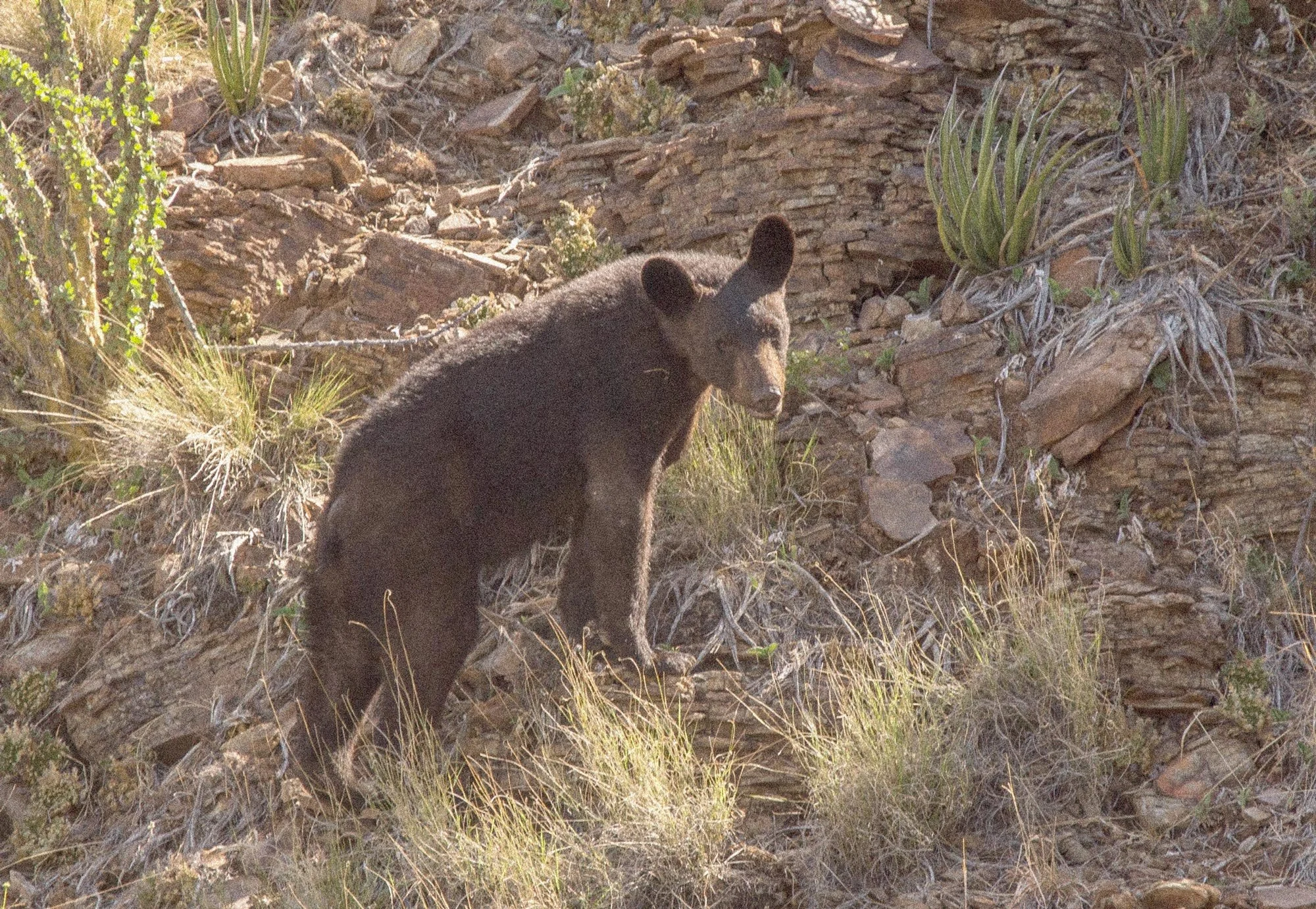
A black bear in the Chisos Mountains of Big Bend National Park. NPS Photo / C.A. Hoyt.
No reintroduction program brought them back. Bears moved north from Mexico, crossed the desert and the Rio Grande, and began appearing again in the Chisos. Females eventually arrived, cubs were born, and a breeding population reestablished itself inside the national park.
Researchers later documented movement in the other direction. During a severe drought in 2000, bears were tracked leaving the park and traveling south into Mexico.⁵ The population in Big Bend was connected to a larger range extending beyond the park and across the international boundary.
A visitor encountering a black bear in the Chisos today is seeing the result of that connection. Bears survived elsewhere, and enough usable habitat remained between the mountains of northern Mexico and West Texas for them to make the journey. The Rio Grande presents the same question of connection at a much larger scale.
A River That Depends on Both Countries
The Rio Grande gives Big Bend its name, defines its southern boundary and carved Santa Elena, Mariscal and Boquillas canyons. Its course through the park suggests a continuous river flowing south from Colorado and New Mexico, but upstream dams and agricultural diversions have dramatically altered what reaches West Texas.
By the time the Rio Grande leaves El Paso, so much water has been diverted that the riverbed between El Paso and Presidio is often dry. Near Presidio, the Rio Conchos enters from Mexico and restores much of the flow. Depending on annual rainfall, the National Park Service estimates that roughly 69 to 86 percent of the water in the Rio Grande downstream from Presidio comes from the Rio Conchos watershed in western Chihuahua.⁶
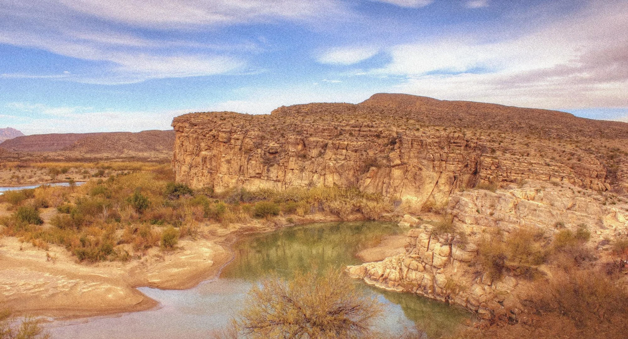
Rio Grande, Big Bend region. Photo: Yinan Chen / Public Domain
Water management in Big Bend therefore reaches far beyond the park. Drought and withdrawals affect flows; lower water levels encourage sediment accumulation and alter habitat. Invasive plants including tamarisk and giant cane have spread through portions of the river corridor, narrowing channels and changing conditions along the banks.
Restoration has become a cross-border undertaking. American and Mexican land managers, scientists and conservation organizations have worked on invasive plant removal, habitat restoration and environmental flows. Big Bend continued that work in early 2026 with another project targeting invasive tamarisk along the Rio Grande. The Park Service noted that dense stands of tamarisk trap sediment, crowd out native vegetation and alter river habitat; the removal project was intended to improve sediment movement, floodplain function, native habitat and recreational access.⁷
The river may define where the United States ends on a map, but managing it requires attention to watersheds, reservoirs, agriculture and rainfall extending hundreds of miles into both countries. Communities along the river have faced a similar reality for much of their history.
Boquillas and the Human Border
From the eastern side of Big Bend, the Mexican village of Boquillas del Carmen sits just across the Rio Grande. The distance is small enough that visitors on the American bank can look directly into the community.
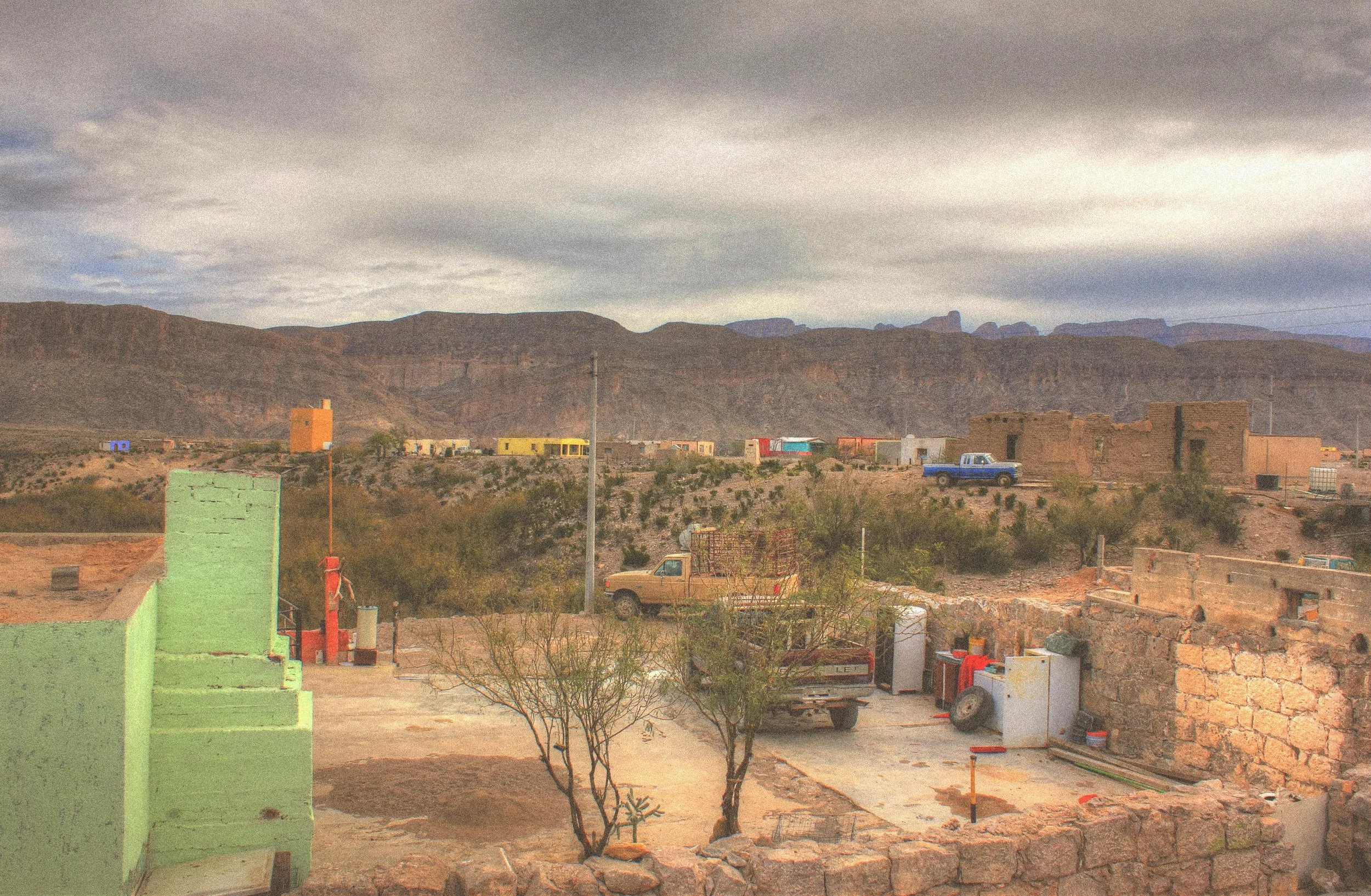
Photo: Yinan Chen / Public Domain
For much of the twentieth century, crossing between Big Bend and Boquillas was informal. Park visitors went across the river for meals, handmade goods or an afternoon in the village, while residents of Boquillas crossed in the other direction. Tourism from Big Bend became an important source of income for the community.
The arrangement ended as the United States tightened border security after the September 11 attacks. In May 2002, the Boquillas crossing was closed, eliminating the informal international crossing that had connected the village with Big Bend.⁸ The closure lasted nearly eleven years.
The Boquillas Port of Entry opened on April 10, 2013, restoring legal access under a formal system.⁹ Visitors now need appropriate passport documentation and must cross while the port is operating. From there, the trip into Boquillas remains remarkably short: across the Rio Grande and then into the village, where restaurants, guides and vendors once again receive visitors from the national park.
The physical distance between Big Bend and Boquillas never changed during the years the crossing was closed. What changed was whether people were permitted to move across it, and the effects were felt directly in a community whose economy had developed partly around visitors from the park. That history now forms part of the context for another change taking place along the border.
The Border Changes Again
The Big Bend Border Dispute — Legal Timeline
The proposed border infrastructure in Big Bend remains the subject of ongoing legal challenges. This timeline tracks the major developments, with sources noted for readers who want to follow the proceedings. We'll update it as significant decisions are made.
| FEB–JUL 2026 | DHS issues and amends construction waivers. | [15] |
| AUG 2026 | Construction activity begins; legal challenges follow. | [10][14] |
| SEP 2026 | CBP extends voluntary construction pause. | [11] |
| OCT 02 | Federal court issues preliminary injunction halting construction. | [15] |
| OCT 14 | Written opinion explains the court's injunction. | [15] |
| OCT 21 | DOJ asks Supreme Court to stay the injunction. | [16] |
As of September 2026, the future of new border infrastructure in Big Bend remains unsettled, but the project has already moved beyond the planning stage.
The federal government has pursued a broader program of barriers, patrol roads and detection systems along the southwest border, including portions of the Big Bend region. Federal requirements were waived to expedite border construction, and inside Big Bend National Park crews subsequently began clearing vegetation and conducting ground-disturbing work associated with proposed roads, vehicle barriers and detection technology.¹⁰
Heavy equipment entering the park in August drew immediate opposition, and Customs and Border Protection paused the work while Commissioner Rodney Scott visited the region and met with local officials. After an initial extension through mid-September, CBP informed a federal judge that ground-disturbing activity on the Big Bend 2 and Big Bend 4 projects would remain paused through September 30, 2026, to allow additional public engagement.¹¹ Government attorneys have also said final decisions about exactly what infrastructure will ultimately be built inside the national park have not yet been made.¹²
CBP argues that additional infrastructure will help agents detect illegal crossings, respond more quickly and prevent trafficking routes from shifting into Big Bend as enforcement increases elsewhere along the border. The agency has cited the challenges of operating across a large, remote and rugged region.¹⁰
The scale of current activity provides important context. The Big Bend Sector is the largest Border Patrol sector geographically but the least active in migrant encounters. In fiscal year 2025, CBP recorded 3,096 encounters there, roughly 1.3 percent of encounters along the U.S.–Mexico border. During the first seven months of fiscal 2026, the sector recorded 1,236 encounters, a decline of 42.5 percent from the same period a year earlier.¹³
Opposition to the project has included arguments about conservation as well as questions about whether extensive physical infrastructure is appropriate for this particular stretch of border. The resistance has not fallen neatly along party lines. Sheriffs from Brewster, Culberson, Hudspeth, Presidio and Terrell counties—a mix of Democrats and Republicans—have argued that a continuous physical wall would not be the most practical or strategic approach to border security in the region. A bipartisan group of 46 members of the Texas House also called for construction to stop while the plans were reconsidered.¹⁰
The potential effects extend beyond the footprint of a barrier. Roads, drainage structures, erosion controls, lighting, cameras, sensors and construction access can alter habitat and wildlife movement while disturbing areas that have remained largely undeveloped. A federal lawsuit that includes People of La Junta for Preservation, Far Flung Outdoor Center and two individual plaintiffs argues that the work threatens archaeological sites and landscapes of cultural and religious significance to Indigenous people.¹⁴
However the temporary pause is eventually resolved, some physical disturbance has already occurred. The question facing Big Bend is no longer simply whether new infrastructure might be proposed. It is how far that infrastructure will extend into the park, what form it will take, and what will be lost or changed in the process.
October 2026 Update
The legal situation changed considerably in October. On October 2, U.S. District Judge Kathleen Cardone issued a preliminary injunction halting border-barrier construction and related ground-disturbing activities throughout the Big Bend Sector unless the federal government complies with applicable laws. The order also temporarily suspended the effect of several waivers the Department of Homeland Security had issued to expedite construction, including those affecting Big Bend National Park. [15]
In a written opinion issued October 14, the judge concluded that the plaintiffs had demonstrated a likelihood of success in challenging the scope of DHS's authority to waive those legal protections. The ruling came in a separate lawsuit brought by Friends of the Ruidosa Church, the Center for Biological Diversity, and a local resident. [15]
The administration challenged the decision. On October 21, the Justice Department filed an emergency application with the U.S. Supreme Court asking it to lift the injunction. The government argues that federal law authorizes the Secretary of Homeland Security to waive legal requirements that would otherwise delay border construction. [16]
As of October 22, the injunction remains in place. It applies to the broader Big Bend Border Patrol Sector, extending beyond the boundaries of the national park. The Supreme Court could change the situation, but the underlying dispute over border infrastructure in Big Bend remains unresolved. [15][16]
For the People Who Live Here
Terlingua, Study Butte and other nearby communities depend heavily on people traveling to experience Big Bend. Outfitters put visitors on the Rio Grande, guides take them into the desert, and restaurants, lodging operators and retailers make a living from people who have come a long way to spend time in this particular landscape.
Far Flung Outdoor Center is one of the businesses that has chosen to act. The longtime Terlingua outfitter has spent decades taking visitors onto the Rio Grande and into the Big Bend country, and in August 2026 it joined People of La Junta for Preservation and two individual plaintiffs in a federal lawsuit seeking to stop border-related construction inside the national park.¹⁴
Habilis has a connection to Far Flung as well: the shop carries our Big Bend shirts. That relationship is worth acknowledging, but it isn't why this issue matters to us. The concern is the same one that runs through much of our work—what happens to the parks, public lands and wild places people care about, and what is lost when those landscapes are permanently altered.
Far Flung belongs in this story because they are doing more than voicing concern from the sidelines. They work in this landscape, know it closely, and have chosen to put their name behind an effort to protect it. Their involvement offers a local example of how seriously the current dispute is being taken by people whose lives and work are tied directly to Big Bend.
The lawsuit raises issues that extend well beyond tourism. Its plaintiffs argue that construction threatens archaeological resources and places of cultural and religious significance to Indigenous people, along with the landscape surrounding them. Far Flung's participation also brings the interests of a local recreation business directly into the case. These claims remain before the court; the ground-disturbing work that prompted the lawsuit had already begun before the current pause.¹⁴
For businesses built around Big Bend, protecting the landscape and protecting a livelihood aren't easily separated. The qualities that bring people to the region—the undeveloped river corridor, dark skies, wildlife, desert and sheer distance from almost everything—are also unusually vulnerable to permanent changes on the ground. Far Flung's decision to become a plaintiff makes that connection unusually explicit.
The Future of Big Bend
The advocates who proposed an international park in the 1930s were responding to a basic geographical problem. The landscape they wanted to preserve extended into another country.
A single international park never emerged from their proposal. Instead, the United States established Big Bend while Mexico later protected large areas of its own. Over time, conservation work developed between those lands. Black bears returned to Texas from Mexico. The Rio Conchos became essential to maintaining the river through the park. Migratory species continued moving through both countries, and the crossing at Boquillas eventually reopened after nearly eleven years of closure.
Border enforcement now adds another layer to that history. The United States has responsibility for managing its international boundary, while the National Park Service has responsibility for protecting the natural and cultural resources of Big Bend. Along this particular stretch of the Rio Grande, those responsibilities occupy much of the same ground.
The current dispute therefore reaches beyond the question of whether a country should enforce its border. In Big Bend, it also concerns what that enforcement requires on the ground, and whether roads, barriers and supporting infrastructure can be reconciled with a national park whose ecological connections extend directly across the river. Whatever decisions are ultimately made will leave physical consequences after the present political argument has moved elsewhere.
At Santa Elena Canyon, the Rio Grande enters a narrow passage between limestone walls rising more than a thousand feet above the water, with Texas on one bank and Chihuahua on the other. Standing at the mouth of the canyon, a visitor can watch the river disappear between them while the same layers of rock continue along both sides.
Sources & Notes
National Park Service — “Park Statistics,” Big Bend National Park.
Park establishment dates, approximately 700,000 acres transferred at establishment, 118 miles of international boundary, and the current transboundary protected landscape of more than three million acres.National Park Service — “Human History of Big Bend.”
Historical settlement, mining, farming and development of communities within the Big Bend region, along with the long cultural history preserved within the park.National Park Service — “Partners in Protection of the Chihuahuan Desert.”
1933 Alpine Chamber of Commerce international-park proposal; Senator Morris Sheppard's February 1935 letter to Roosevelt; congressional authorization of Big Bend; and Harold Ickes's request that the State Department seek Mexican participation in an international peace park.Commission for Environmental Cooperation — “Conservation Assessment for the Big Bend–Río Bravo Region.”
Documents Roosevelt's 1944 correspondence with Mexican president Manuel Ávila Camacho calling for the protected landscape on both sides of the Rio Grande to form an international park.National Park Service — “Bear Research: Fall 2000.”
History of black bear extirpation in the Big Bend region, natural recolonization from northern Mexico beginning in the late 1980s, and documented movement of bears from Big Bend back into Mexico during drought.National Park Service — “The Rio Grande.”
Upstream diversions, the frequently dry riverbed between El Paso and Presidio, and the estimate that 69–86 percent of Rio Grande water downstream of Presidio can originate in Mexico's Rio Conchos watershed.National Park Service — “Invasive Tree Removal Along the Rio Grande,” January 27, 2026.
Tamarisk removal project and NPS explanation of its effects on sediment, native vegetation, wildlife habitat, floodplains and river access.U.S. Department of Justice / Federal Register — Proposed Boquillas Crossing Rule, 2011.
Confirms that visitors had crossed informally prior to 2002 and that the Boquillas crossing was closed in May 2002 following the September 11 attacks.National Park Service — “Boquillas Port of Entry.”
Confirms the formal port opened April 10, 2013, its role in U.S.–Mexico conservation cooperation and tourism in Boquillas del Carmen, and the passport requirement for visitors.The Texas Tribune — Uriel J. García and Alex Ford, “What to Know About Possible Border Barriers in Big Bend,” August 18, 2026, updated August 25, 2026.
Federal infrastructure plans, vehicle barriers and detection technology; federal waivers; construction activity; CBP's security rationale; bipartisan local opposition; the five West Texas sheriffs; and the 46-member bipartisan Texas House coalition.Rachel Frazin, The Hill — “CBP Extends Pause of Some Border Construction, Including in Texas National Park,” September 3, 2026.
CBP's agreement to pause ground-disturbing activity on the Big Bend 2 and Big Bend 4 projects through September 30, 2026, for additional public engagement.Associated Press — “Federal Government Extends Pause on Big Bend National Park Border Construction,” August 29, 2026.
Initial extension of the construction pause, status of proposed road, detection technology and barriers, and the government's position that final plans within the park remained unsettled.The Texas Tribune — “Feds Threaten Land Seizures for Border Wall in Big Bend Area,” June 15, 2026.
CBP encounter data: 3,096 Big Bend Sector encounters in fiscal 2025, representing roughly 1.3 percent of the southwest-border total; 1,236 encounters during the first seven months of fiscal 2026, down 42.5 percent from the comparable prior-year period.The Texas Tribune — Ayden Runnels and Gabby Birenbaum, “Lawsuit Seeks to Stop Big Bend Border Wall Construction,” August 14, 2026; U.S. District Court docket, People of La Junta for Preservation et al. v. Department of Homeland Security et al.
Plaintiffs include People of La Junta for Preservation, Far Flung Outdoor Center, Andrew Austin and Christina Hernandez. The suit alleges threats to archaeological sites, sacred and culturally significant landscapes and Indigenous religious rights from roads, drainage structures, erosion controls, lighting, cameras, sensors and related work.U.S. District Court for the Western District of Texas. Friends of the Ruidosa Church v. Mullin, Memorandum Opinion and Order, October 14, 2026.
https://www.govinfo.gov/content/pkg/USCOURTS-txwd-3_26-cv-01099/pdf/USCOURTS-txwd-3_26-cv-01099-0.pdfU.S. Department of Justice. Emergency Application to Stay the Preliminary Injunction, U.S. Supreme Court, October 21, 2026.
https://www.supremecourt.gov/DocketPDF/26/26A560/430290/20261021153649084_Ruidosa_Application_Final.pdf