California Highway 1 Road Trip: Big Sur and the Central Coast
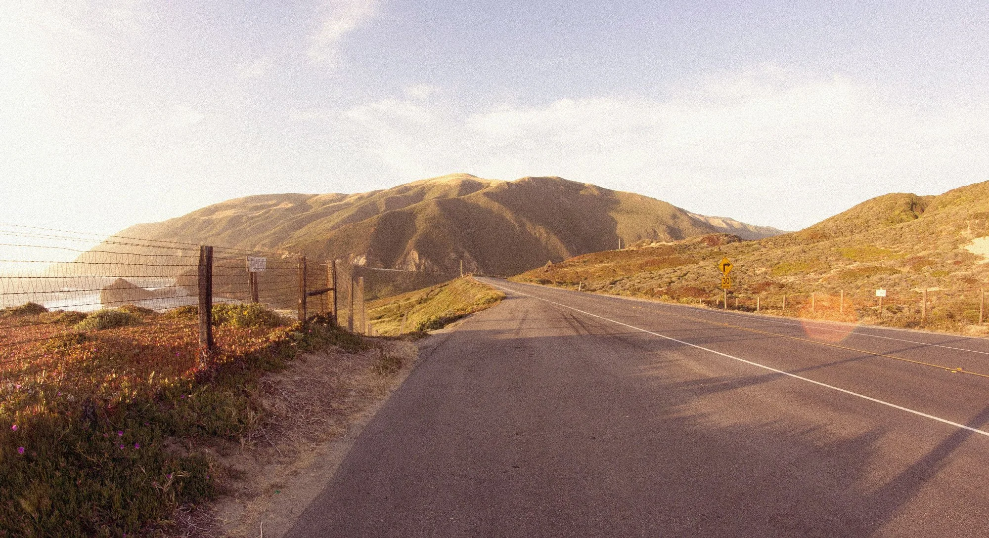
Highway 1 follows one of California's great changes in landscape. From Santa Barbara, the road moves through beach towns, farmland and low coastal hills before reaching the Santa Lucia Mountains, where the terrain rises abruptly from the Pacific and the highway begins tracing cliffs, crossing canyons and dropping into redwood forest.
This guide follows the Central Coast north through San Luis Obispo, Morro Bay, Cambria and San Simeon before entering Big Sur and eventually reaching Carmel. Along the way are some of California's best-known landmarks, along with working harbors, wildlife, beaches, old roadside businesses and places that grew out of the unusual communities that formed along this once-isolated coast.
Use the route loosely. A beach, trail or long lunch can easily change the shape of a day here. Leave some room for that.
Highway 1 Road Trip at a Glance
Before You Go
Conditions are part of planning a Highway 1 trip through Big Sur. Wildfires, winter storms, landslides and road repairs have all affected access along the coast, sometimes for extended periods. Individual parks and trails may close while the highway remains open.
Check Caltrans QuickMap, California State Parks and Los Padres National Forest shortly before leaving. Current information matters more here than an itinerary written months earlier.
Fuel is available in Big Sur, although options are limited and prices reflect the location. Cell service disappears along substantial portions of the coast, so download maps before entering the more remote sections. Carry water and bring a layer even when the inland forecast is warm; temperatures along the immediate coast can be surprisingly cool.
Camping and popular lodging require more advance planning. Anyone hoping to spend the night in Big Sur should make those arrangements early.
Santa Barbara to San Luis Obispo
The southern end of the route begins in a relatively settled part of the California coast. Santa Barbara and San Luis Obispo make useful anchors for this first stretch, with plenty of room to wander between them.
Santa Barbara
Santa Barbara is an easy place to begin slowly. The waterfront, palm-lined streets and Spanish Colonial Revival architecture provide a distinctly Southern California starting point before the road turns toward the more agricultural Central Coast.
For travelers arriving from Los Angeles, breakfast or lunch and a walk along the waterfront can be enough to make Santa Barbara part of the trip rather than simply the place where the drive begins. Those with more time can head downtown or visit the Old Mission before continuing north.
Beyond Santa Barbara, the landscape opens into ranchland and agricultural valleys. Numerous possible detours run through this part of the Central Coast, so there's little reason to over-plan the stretch.
San Luis Obispo
Downtown San Luis Obispo is compact and walkable, centered around Mission San Luis Obispo de Tolosa and the creek running through town. Restaurants, shops and cafés make it a practical place for a longer break or an overnight.
SLO also marks a transition in the trip. Head west and the ocean returns to the foreground. Before long, the unmistakable profile of Morro Rock appears ahead.
Morro Bay to San Simeon
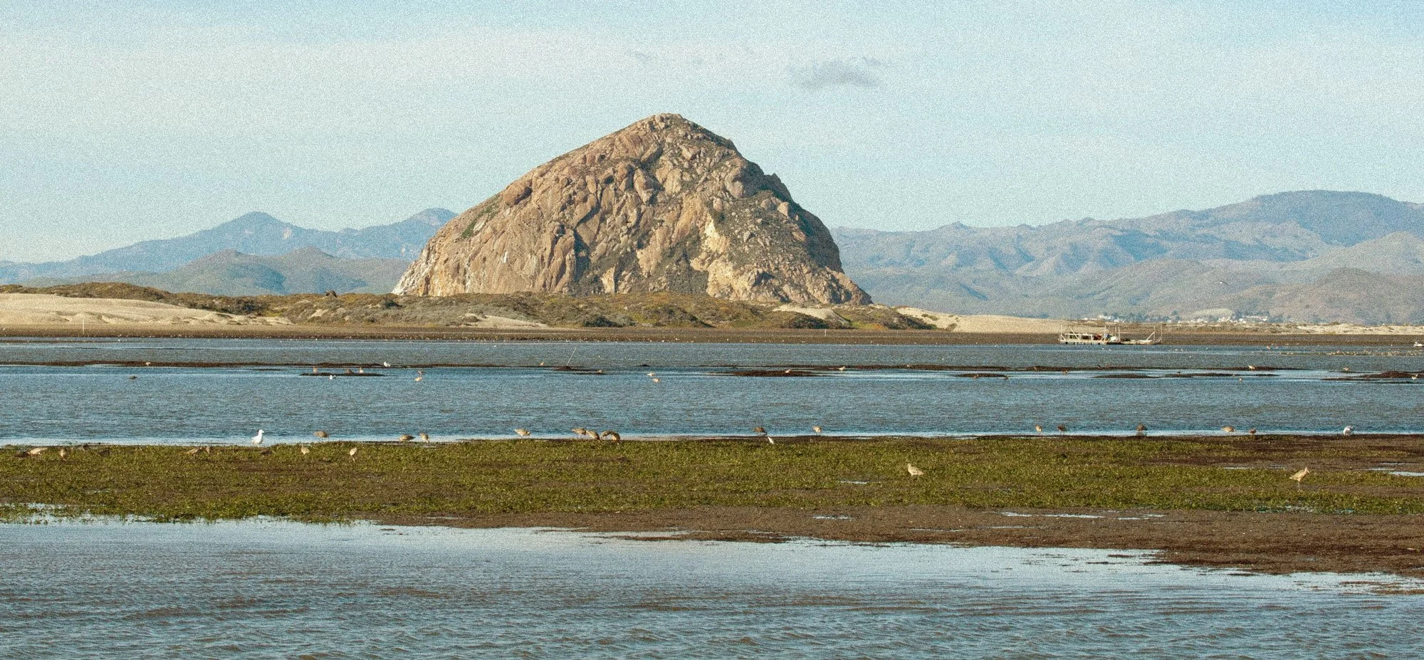
Credit: Michael L. Baird
A remarkable amount changes along this relatively short section of coast. There's a working harbor, quiet beach towns, an extravagant hilltop estate and a major wildlife rookery before the road reaches the mountains of Big Sur.
Morro Bay
Morro Rock rises about 576 feet above the entrance to the harbor, the most prominent of a chain of ancient volcanic plugs known as the Nine Sisters. Its scale becomes much more apparent from the waterfront and the road approaching its base.
The protected bay and estuary are equally compelling. Sea otters are frequently visible around the harbor, and the wetlands support abundant birdlife. A walk along the waterfront or toward the rock is an easy introduction to a part of the Central Coast where wildlife becomes increasingly prominent as the trip moves north.
Highway 1 continues through Cayucos before reaching Cambria. Moonstone Beach makes an easy addition here, with a coastal boardwalk and numerous access points. Cambria itself works well for a meal, supplies or an overnight before San Simeon.
Hearst Castle
Hearst Castle appears above the coast like something imported from another world.
Beginning in 1919, newspaper publisher William Randolph Hearst worked with architect Julia Morgan to transform the hilltop into an enormous estate of guest houses, gardens, pools and the main residence Hearst called La Cuesta Encantada—the Enchanted Hill. Construction and revision continued for decades.
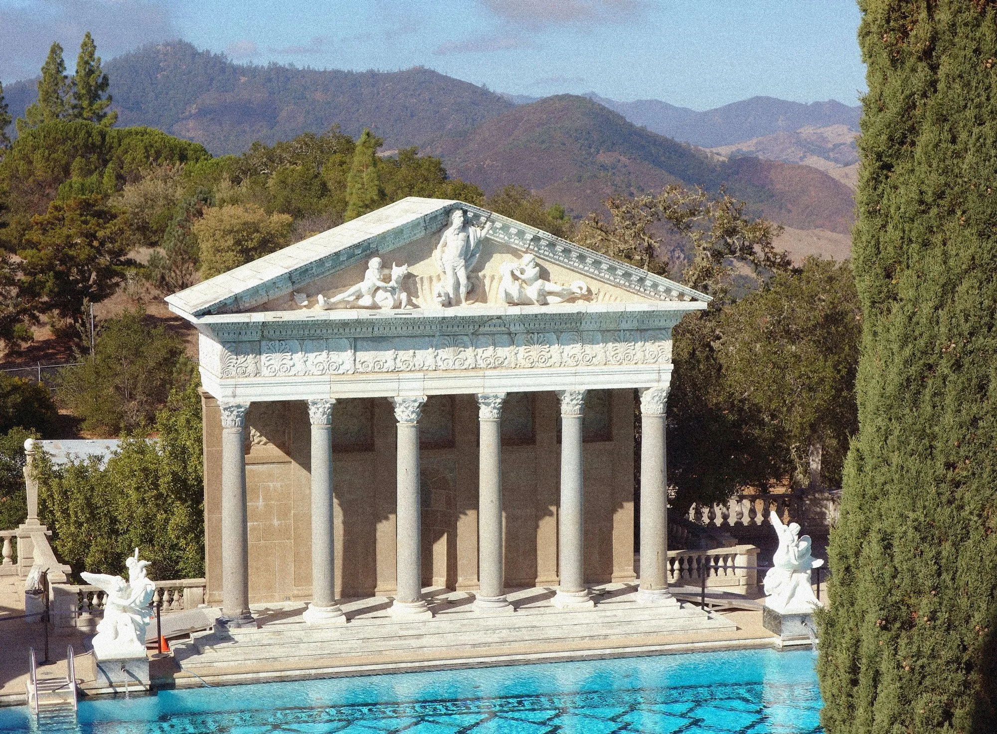
Neptune Pool at Hearst Castle, San Simeon. Photo: Daderot / Wikimedia Commons, CC0.
Morgan was the first woman certified to practice architecture in California and went on to design hundreds of buildings during her career. At San Simeon, she had the unusual task of finding a home for Hearst's vast collection of European art and architectural fragments while accommodating a stream of ideas that continued to evolve as the estate grew. The result is extravagant and eccentric, but Morgan gave the sprawling project an underlying coherence.
Seeing the estate requires some planning. Tours depart from the visitor center below the hill, and advance reservations are a good idea during busy periods.
A few miles farther north, the Piedras Blancas Elephant Seal Rookery offers a dramatic change of scene. Depending on the season, large numbers of northern elephant seals gather along this stretch of coast to breed, give birth, molt and rest.
The viewing areas are free and require no reservation. Stay on the established paths and observe the seals from a distance. Adult males can weigh several thousand pounds, a scale that becomes much easier to appreciate when one raises its head above a beach crowded with smaller animals.
Past Piedras Blancas, development begins falling away. The Santa Lucia Mountains draw closer to the Pacific, and Highway 1 enters its most dramatic terrain.
The Southern Big Sur Coast
Big Sur arrives gradually. Ranchland gives way to steeper slopes, the mountains crowd the water, and settlements thin out until the highway seems to be hanging between two much larger things.
Ragged Point is a natural place to stop and take in that change. Farther north, Salmon Creek Falls, Sand Dollar Beach and Limekiln offer opportunities to get away from the pavement. Some require only a short detour; others can occupy much more of the day. Access changes frequently enough that these are best chosen according to current conditions and whatever pace the trip has taken by then.
The road itself deserves some attention here. The modern Carmel–San Simeon Highway was authorized in 1919, and construction began in 1922. Crews spent the next fifteen years working across cliffs, canyons and unstable slopes before the route was completed in 1937. A formal grand opening followed in 1938.
That new access changed Big Sur. Travelers arrived in greater numbers, followed by businesses serving them and newcomers drawn to the coast. Geography continued to impose its own limits. The mountains, narrow canyons and long stretches of undeveloped shoreline resisted the continuous development found along many other parts of the California coast. Much of Big Sur's later character grew from the uneasy coexistence of those two forces: access and isolation.
Julia Pfeiffer Burns State Park and McWay Falls
McWay Falls has become one of the defining images of Big Sur. McWay Creek drops roughly 80 feet toward a small cove below Highway 1, framed by cliffs and open Pacific.
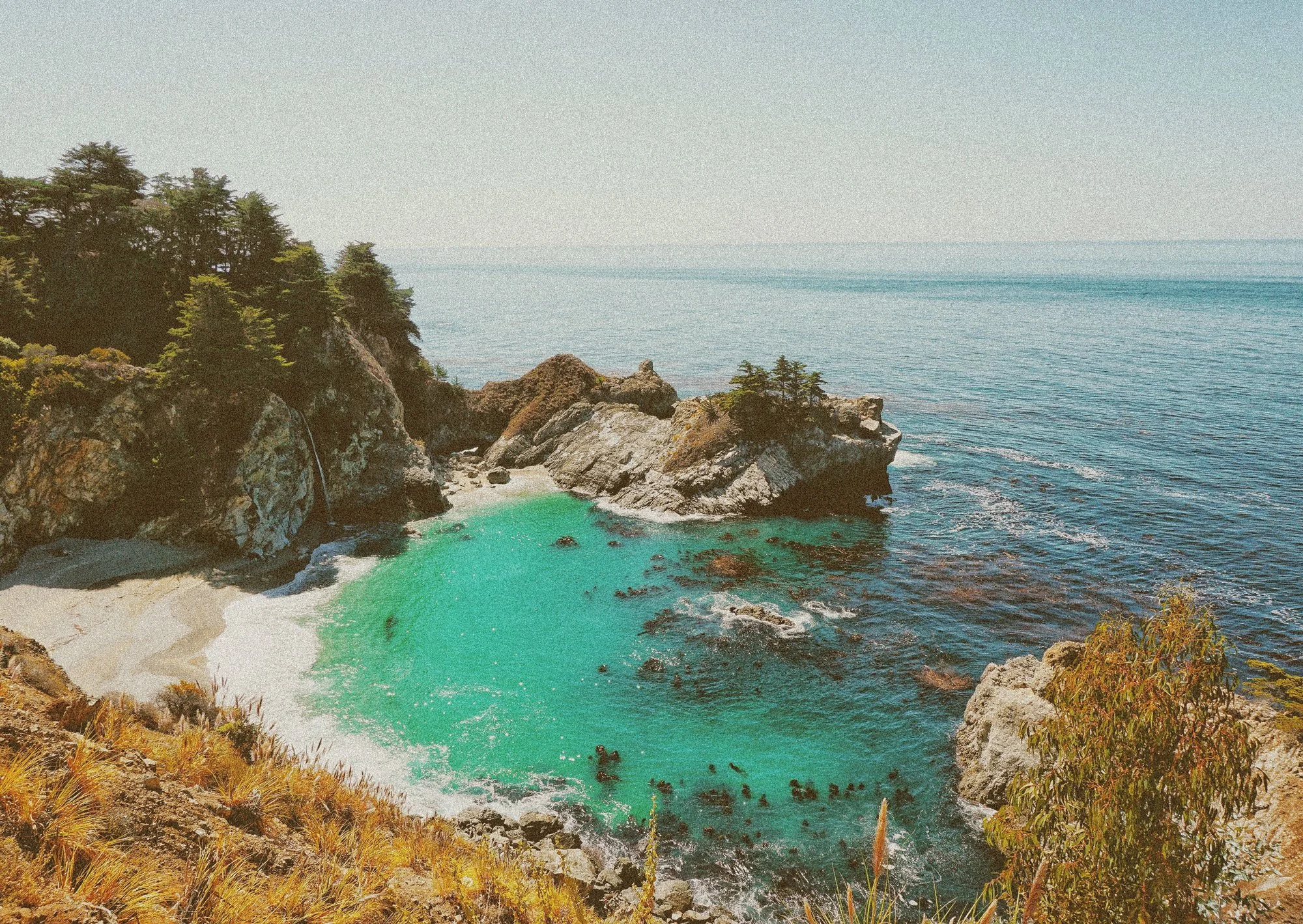
McWay Falls at Julia Pfeiffer Burns State Park in Big Sur. Photo: Michael DePetris / Wikimedia Commons, CC0.
The falls lie within Julia Pfeiffer Burns State Park, named for a well-respected Big Sur pioneer. The park extends far beyond the famous overlook, reaching inland toward ridges rising roughly 3,000 feet and protecting redwood forest on the eastern side of the highway.
There is no public beach or ocean access at McWay Falls. The cove, cliffs and areas beyond the established barriers are closed, while conditions affecting the overlook and surrounding trails can change. Check the current State Parks information before arriving.
Three nearby destinations share versions of the same name, which creates understandable confusion:
Julia Pfeiffer Burns State Park — McWay Falls
Pfeiffer Big Sur State Park — Big Sur River, redwoods and camping
Pfeiffer Beach — beach and Keyhole Arch
They sit along the same general stretch of coast but offer three very different Big Sur experiences.
The Heart of Big Sur
Central Big Sur reveals how quickly the landscape can change. Open ocean views give way to protected river canyons filled with redwoods, then reappear a few miles later. Businesses, parks and cultural institutions are scattered along the highway rather than concentrated around a traditional town center. Over time, a handful of those places became gathering points for residents and travelers alike.
Pfeiffer Big Sur State Park and the Redwoods
Follow the Big Sur River inland and the exposed coastline quickly gives way to shade.
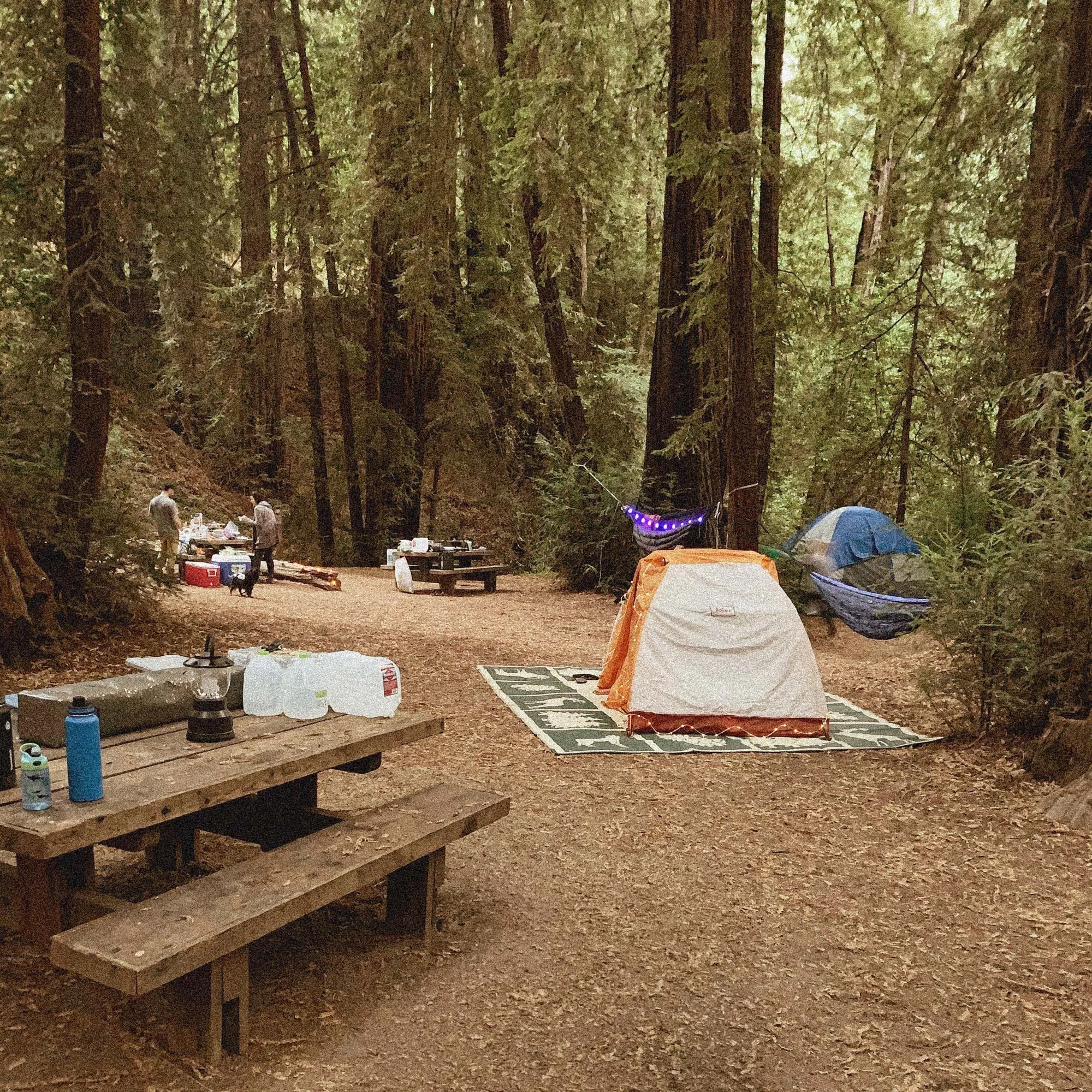
Camping beneath the redwoods at Ventana Campground in Big Sur. Photo: Habilis Supply Co.
Pfeiffer Big Sur State Park protects a forest of redwoods, sycamores, oaks and other native trees along the river, with trails climbing from the canyon into the surrounding Santa Lucia Mountains. Its large campground has made the park one of Big Sur's longstanding places to sleep beneath the trees.
The contrast with the coast is part of the appeal. Photographs of Big Sur tend to favor cliffs and blue water, while much of the experience on the ground happens in cool river canyons only a short distance away. Spending time among the redwoods reveals how much ecological variety is packed into a narrow strip between the mountains and ocean.
Several private campgrounds around the Big Sur River and neighboring canyons offer additional tent, RV and cabin options among the trees. Facilities and reservation systems vary, and campsites throughout Big Sur can be difficult to secure during popular travel periods. Camping is one part of this trip best arranged before leaving home.
Nepenthe: Big Sur's Living Room
Nepenthe occupies a terrace high above the Pacific, where generations of travelers have stopped to eat, look out over the coast and linger longer than they planned.
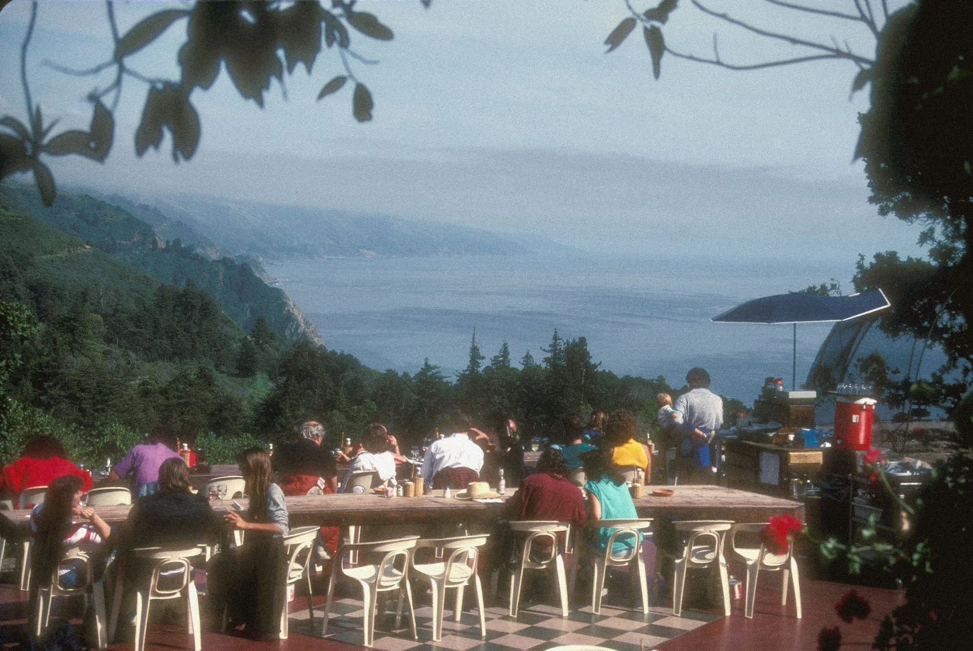
The terrace at Nepenthe overlooking the Big Sur coast. Photo: Jerrye & Roy Klotz / Wikimedia Commons, CC BY-SA 3.0.
A cabin had stood on the property since the 1920s when Orson Welles and Rita Hayworth acquired it in 1944. They imagined a retreat along the Big Sur coast, though their plans for the property never fully developed. Bill and Lolly Fassett purchased it a few years later and began creating a gathering place of a different kind.
The Fassetts hired architect Rowan Maiden, who studied with Frank Lloyd Wright through the Taliesin Fellowship, to design the restaurant. Nepenthe opened in 1949. Maiden used wood, stone, broad windows and outdoor terraces to frame the surrounding landscape, with a large fireplace anchoring the interior. From the terrace, nearly everything directs attention toward the Pacific.
The timing placed Nepenthe at the center of a changing Big Sur. Highway 1 had opened the coast little more than a decade earlier, and the region was attracting a loose community of writers, painters, musicians and people interested in living beyond the routines of California's growing cities. Residents were scattered along miles of highway with few central gathering places. Nepenthe became one of them.
Lolly Fassett eventually called it “Big Sur's living room.” Henry Miller was among its regulars, and the restaurant's history accumulated an eclectic collection of artists, actors, musicians and travelers. Poetry, dancing, conversation and long afternoons became part of the place's identity.
Much of the appeal is still apparent from the terrace. Tables look across an enormous sweep of Pacific, the Santa Lucia Mountains rise immediately behind the highway, and swallows can sometimes be seen cutting through the air around the property and neighboring coast. They're a small part of the scene, easily missed until someone at the table happens to look up.
Downstairs, Phoenix Shop has been part of the property since 1964, carrying artwork, jewelry, books, clothing and other objects selected from California and beyond. The shop also carries Habilis Supply Co., including our Big Sur shirt and designs inspired by other California destinations.
Nepenthe's long history makes it unusual among famous roadside stops. The Fassett family remains involved generations after the restaurant opened, travelers continue to fill the terrace, and the experience remains closely connected to the road and landscape that created it.
Big Sur's Artists, Writers and Outsiders
The opening of Highway 1 coincided with a period when writers, painters and other artists were establishing a loose creative community along the Big Sur coast. Isolation remained part of its appeal even as reaching the area became easier. The landscape, relative freedom and distance from city life drew people who often had little else in common.
Henry Miller became the figure most closely associated with this period. He arrived in Big Sur in 1944 and stayed for nearly two decades. His writing introduced many readers to a Big Sur populated by neighbors, artists and outsiders living within the landscape rather than simply passing through it.
The creative history extended well beyond Miller. Painters and photographers worked throughout the region, while the artistic communities around Carmel and Big Sur frequently overlapped. Edward Weston, living near Point Lobos, produced some of his best-known photographs along this coast. Writers and musicians arrived for shorter stays, adding to a cultural reputation that grew alongside Big Sur's popularity with travelers.
The Henry Miller Memorial Library carries some of that history forward. Miller's friend, painter Emil White, turned his Big Sur home into a memorial to Miller in 1981. The site evolved into a bookstore, gallery, performance space and cultural center tucked beneath the redwoods beside Highway 1.
Its modest scale suits the setting. Visitors can browse the books, see a current exhibition or check the calendar for performances and events. More than forty years after its founding, the library remains part of Big Sur's active creative life.
Pfeiffer Beach
A narrow road descending from Highway 1 leads to Pfeiffer Beach, known for its offshore rock formations, Keyhole Arch and occasional patches of purple sand created by mineral deposits washing out of the surrounding hills.
Wind, surf and fog can make conditions here feel very different from the protected river canyon a few miles away. The offshore rocks give the beach its distinctive profile, particularly when late-day light passes through Keyhole Arch.
Parking is limited and the access road is easy to miss. Check current Los Padres National Forest information before heading down Sycamore Canyon Road.
Northern Big Sur to Carmel
The northern coast brings some of Highway 1's most recognizable scenery, along with heavier traffic around its best-known viewpoints. Bixby Creek Bridge draws much of the attention, while Garrapata and Point Lobos offer good reasons to spend more time outside the car.
Bixby Creek Bridge
Bixby Creek Bridge was completed in 1932, five years before the Carmel–San Simeon Highway was completed. Its concrete arch crosses a deep coastal canyon and remains one of the defining pieces of Highway 1's original engineering.
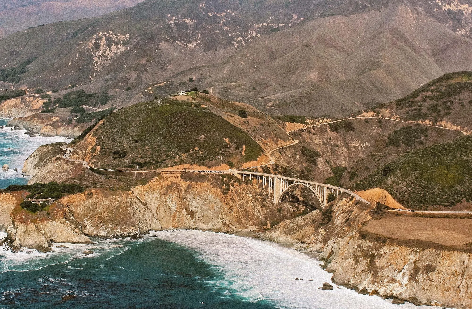
Bixby Creek Bridge along California Highway 1 in Big Sur. Photo: Chris Leipelt / Wikimedia Commons, CC0.
The viewpoints can become crowded, especially during busy travel periods. Use established pullouts and stay clear of traffic; if the obvious parking areas are overwhelmed, continue north. A little distance can actually make the scale of the bridge—and the difficulty of building a road through this terrain—easier to appreciate.
Nearby Garrapata State Park offers coastal bluffs, beaches and trails climbing into the hills. Spring can bring wildflowers across the terraces, while the open coastline provides broad Pacific views throughout the year. It's an easy place to trade another roadside photograph for a walk.
Point Lobos State Natural Reserve
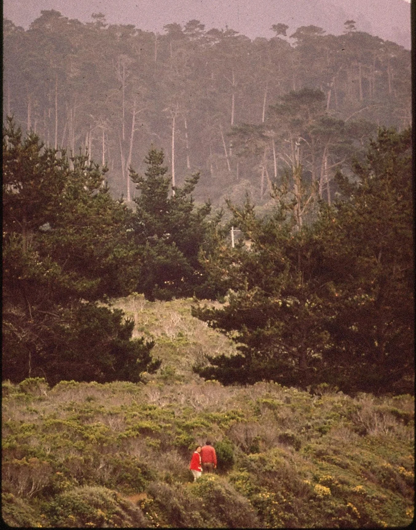
Visitors at Point Lobos State Reserve, 1972. Photo: Dick Rowan / U.S. Environmental Protection Agency, DOCUMERICA Collection, National Archives. Public domain.
Just south of Carmel, Point Lobos State Natural Reserve protects a compact but remarkably varied section of coast. Rocky coves, Monterey cypress, tide pools and offshore kelp forests provide habitat for sea otters, harbor seals, sea lions and an extensive range of birdlife.
A network of trails follows the shoreline and passes through the reserve's forests, connecting rocky coves, exposed headlands and stands of Monterey cypress. Many of the trails can be combined into shorter or longer walks rather than requiring a single destination. After the repeated rhythm of driving and pulling over through Big Sur, Point Lobos offers a chance to leave the car behind and spend a longer stretch of the trip on foot.
It also brings the artistic history of the coast back into view. Edward Weston photographed extensively at Point Lobos, drawn to its cypress, rocks and eroded shoreline. Painters and photographers had already been working along the Monterey Peninsula and Big Sur coast for decades, and the reserve remains an easy place to understand the attraction firsthand. Fog, rock, water and trees continually rearrange themselves with the light.
Parking inside the reserve is limited and often fills on busy days. Walking in from outside the entrance is common when the lots are full.
Carmel-by-the-Sea
Carmel provides a comfortable landing after the sparse settlements of Big Sur. Restaurants, galleries, shops and hotels return within a town small enough to explore largely on foot.
The artistic history continues here as well. Writers, painters and photographers were establishing themselves in Carmel long before Highway 1 opened through Big Sur. Poet Robinson Jeffers and his wife, Una, arrived in Carmel in 1914. Construction of Tor House began in 1918, and Jeffers went on to write his major poetic works there while building the adjacent Hawk Tower from local stone.
Carmel makes a natural endpoint for this route. Travelers continuing north can add Monterey, where the Monterey Bay Aquarium, historic waterfront and Cannery Row can easily fill another day.
When to Drive Highway 1
Each season changes the experience of the Central Coast.
Spring brings green hills, flowing creeks and seasonal wildflowers, with late storms occasionally affecting roads and trails. It's one of the most colorful times to travel the route.
Summer is peak road-trip season. Longer days come with larger crowds, and coastal fog frequently settles over stretches of Highway 1. Temperatures can also be far cooler than they are only a short distance inland. Layers belong in the car even when the forecast elsewhere in California suggests T-shirt weather.
By fall, summer traffic begins easing, and stretches of clear coastal weather can make this an excellent time to travel. Conditions remain variable along the immediate coast as the season progresses.
Winter brings dramatic weather and quieter roads between storms, along with the greatest potential for rain-related landslides, trail closures and highway disruptions. Flexible plans become especially useful.
Weather and road conditions have always shaped travel through Big Sur. Checking them shortly before departure is the best way to know what version of the coast you'll encounter.
The Long Way Around
Highway 1 twists around headlands, crosses deep canyons and disappears beneath redwoods. Beaches require detours, trails consume afternoons, and lunch on a terrace can quietly take over a larger part of the day.
The completion of the Carmel–San Simeon Highway in 1937 changed Big Sur. Easier access brought travelers, and some stayed. They wrote, painted, built homes and established places like Nepenthe that eventually became part of what later generations came to experience.
More than eighty years later, the route still rewards some empty space in the schedule. Know where you're headed, pay attention to conditions, and leave enough room in the plan for whatever makes you stop.
There will always be a faster road.
Keep Exploring
Highway 1 is one piece of a much larger California landscape. Continue inland to the Sierra, follow another stretch of the coast, or start planning a longer trip through the West. For a broader look at when to go and how different destinations fit together, see our Best Time to Visit America’s National Parks: Seasonal Guide & Road Trip Itineraries.